About HydroTech
From vessel operations to data delivery, our team blends local expertise with global survey best practices to support safer offshore and coastal decisions.
Our Story
Nigeria sits atop one of the world's most significant offshore oil and gas reserves. Its waters have been surveyed by some of the most sophisticated equipment on earth. Its rigs have been guided through complex rig moves by precision positioning systems. Its subsea infrastructure has been inspected, measured, and mapped with technology accurate to the centimetre.
Almost none of that technology was designed here. Almost none of it was manufactured here. And almost none of the engineering knowledge required to build, calibrate, or repair it has been developed here.
For decades, Nigerian and West African operators have had no choice but to import survey systems and positioning technology from manufacturers — paying premium prices for equipment, waiting weeks or months for spare parts, and depending on foreign technicians to arrive on international flights every time something needed servicing. In an industry where time is measured, that dependency is not merely inconvenient. It is costly, it is strategically fragile, and it is entirely unnecessary.
HydroTech Survey was founded to build the alternative.
We began as a marine survey company — delivering hydrographic, geophysical, geohazard, metocean, subsea inspection, and environmental monitoring services to operators working in Nigerian and West African waters. Survey services generate the revenue, the field experience, and the real-world technical feedback that every credible equipment manufacturer needs before it can design anything worth buying.
But from the beginning, our ambition was larger than services alone. We started asking the questions that no Nigerian company in this space had seriously pursued: Why does every Integrated Rig Move Control Unit deployed in Nigerian waters come from abroad? Why is there no African manufacturer of inertial navigation systems for marine survey vessels? Why, in a country with a growing engineering talent base and a clear commercial need, has no one built this capability here?
The answer was not that it could not be done. The answer was that no one had committed to doing it.
MERIDIAN-X™ was our first answer.
Our Integrated Rig Move Control Unit — the MERIDIAN-X™ — is the first survey positioning and control system designed, assembled, and supported entirely within Nigeria. It is not a prototype on paper. It is a working system, deployed in the field, built by a Nigerian engineering team, and maintained without a single international flight or foreign service call. It integrates Trimble GNSS positioning, Moxa serial networking, and real-time remote monitoring into a ruggedized portable rack unit that mobilises to any vessel or rig in the time it takes to load a flight case into a car.
It is our proof of concept. And it is only the beginning.
The case for African-made survey systems has never been stronger.
HydroTech Survey was created to be that company — the one that builds the systems, trains the engineers, holds the intellectual property, and demonstrates to Africa's offshore industry and to the world that precision positioning and survey technology can be engineered here, owned here, and trusted here.
We're preparing profiles of the Nigerian engineers, surveyors, and hydrographers building HydroTech Survey.
To deliver world-class hydrographic survey services and engineer the positioning and control systems that underpin safe offshore operations — designed, built, and supported in Nigeria, for Africa and beyond.
To become Africa's foremost designer and manufacturer of marine survey and offshore positioning systems — pioneering a future where the technology that guides Africa's offshore operations is conceived, engineered, and owned within.
Guiding principles that define who we are and how we work
We believe Africa does not have to be a permanent consumer of technology it did not build. Every product we engineer, every system we design, and every local engineer we train is a statement that African innovation belongs at the frontier of offshore technology — not at the tail end of a supply chain.
In survey and positioning work, there is no acceptable margin for guesswork. A rig placed in the wrong position, a pipeline routed over an unmapped hazard, or a navigation system that fails during a rig move can cost lives, assets, and futures. We hold every measurement, every dataset, and every system we build to the standard that our clients' operations demand.
We are a Nigerian company — and we carry that identity as a mark of ambition, not a disclaimer. We hold our work to the same standard as the international OEMs we are here to challenge. Nigerian engineering can be world-class. We are committed to proving it.
In an industry where safety-critical data and positioning information influence decisions worth hundreds of millions of dollars, our word must be our bond. We do not overstate our capabilities; we do not underdeliver on our commitments.
We are not building a company to flip or a contract to fulfil and move on from. We are building an institution — one that trains Nigerian engineers, generates Nigerian intellectual property, and creates a platform that serves Africa's offshore industry for decades. Every decision we make is tested against that long horizon.
Offshore operations are inherently hazardous. We treat safety not as a compliance obligation but as the foundation of everything we do — in the field, in our engineering lab, and in the systems we put on our clients' vessels and rigs. If something we build or deliver cannot be trusted with someone's life, it is not ready.
We're pursuing NCDMB, NUPRC, and international quality accreditations as our programme matures. Details will be published here.
How we work
HydroTech combines marine operations, survey science, and engineering awareness so every project moves with fewer surprises. Our work is structured, documented, and built around the decisions clients need to make.
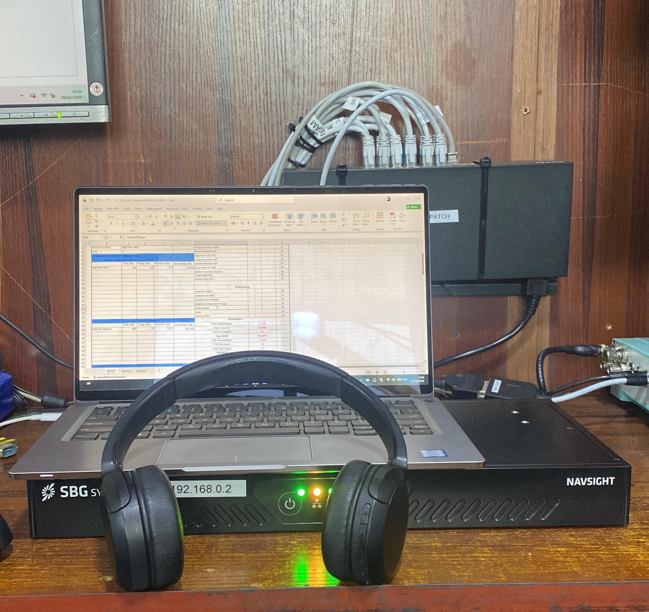
We shape scope, vessel needs, equipment, permits, and data deliverables before mobilization.
Teams collect positioning, bathymetry, sub-bottom, and inspection data with disciplined QA checks.
Specialists validate results, reduce uncertainty, and prepare outputs engineers can rely on.
Clients receive clear charts, logs, summaries, and recommendations for the next project step.